OPE Distributors & Territory Management: Why Geo-Mapping And Location Intelligence Are Game-Changers
by Black Ink Team

For any industry, not just OPE, knowing what an area looks like on a map is not nearly enough information for a manager to base territory management decisions on. After all, not all dealers have equal spending power, and they are rarely if ever distributed evenly in a region. This is where geo-mapping and location intelligence (LI) come into play
Location intelligence encompasses more than just geography. Examples of LI include what demographics the population of a place is comprised of, how many dealers there are inside a certain area, and the past sales performance that products have had in a specific region. LI is crucial for making good territory management decisions. Without taking such facts into consideration, managers risk dissatisfying their sales team by distributing opportunity un-evenly.
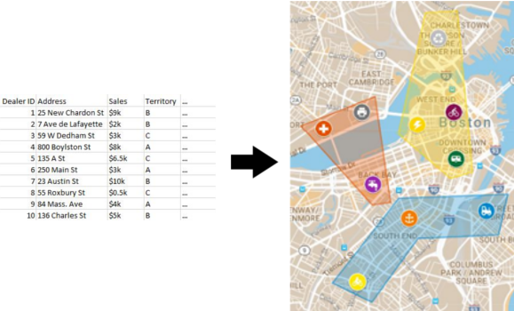
Geo-mapping is a term that refers to the displaying of information over a map. If you have ever watched election results being broadcast on TV, you might have seen it when they “color-in” a map with colors representing whichever candidate won most of the votes for each individual state. By “visualizing” their data in that way, they are making it much easier to “digest.” Geo-mapping can accomplish the same thing with location intelligence.

Useful territory management insights can be made in a roundabout way through clever uses of Excel pivot tables, but a better tool for the job is an industry-specific CRM that integrates geo-mapping and location intelligence. The data visualization and analysis capabilities that this type of software provides the user make territory issues “come alive.”
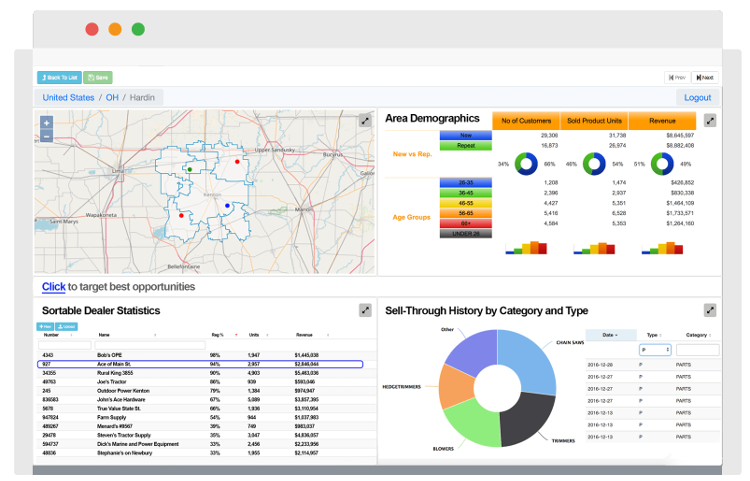
In the basic configuration for such a tool, the screen is divided equally into four sections, each showing either a map, a table, or a chart. Usually right from their browser, territory managers can alter each of these quadrants and have them display whatever they want; one could show an interactive map of the specific region they are working on, another could show a table which ranks their company’s salespeople in terms of sales-made, another could show a graph displaying the total number of sales made in that region during the past five years, and the last could be a further “zoomed-out” map providing geographical context for the region. The layout is completely up to you, and modifying it to make it show the “story” you want is a breeze.

A CRM that integrates geo-mapping and location intelligence takes every “layer” – geography, location intelligence, team members, sales, and others – of data which is necessary for making good territory management decisions and compiles them all together. The end result? One powerful, versatile, and easy-to-use solution.
With this type of tool at their disposal, OPE distributor territory managers can quickly and easily get a sense of how much opportunity exists in any given area, for any given period. In a shorter span of time, they will be able to make reasonable decisions affecting which leads will get assigned to which salespeople. At the end of the day, territory managers will be happier because this tool will be making their job easier, and salespeople will be happier because the approved lists of leads that they receive will have been determined using more advanced processes.
